The view from above is no longer a luxury. The global geospatial analytics market hit roughly $102.7 billion in 2025, according to Grand View Research, and it's rising fast as insurers, farmers, and city planners trade their instincts for overhead data. But a practical question for most buyers is: aerial or satellite?
Both aerial and satellite imagery show our planet from above. Ten years ago the choice was easy: businesses flew planes and helicopters, while satellites belonged to scientists with government funding behind them. Three things broke that pattern. Resolution caught up — a Maxar satellite now picks out objects 30 cm across from orbit, close enough to step on ground that once belonged to aircraft alone. The number of high res satellites exploded, so the same spot gets photographed daily instead of once a month. And online platforms opened satellite tasking request and archive access to ordinary users, no specialist contract needed.
Strip those barriers away and what's left to decide on is accuracy, weather, turnaround, and cost. Choose wrong and you'll overpay, or wait weeks for imagery you can't use. Here's how the two compare, and where each one earns its price.
What is aerial imagery?
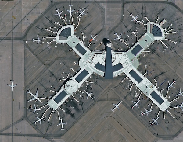
Aerial imagery goes back to 1858, when the first photographs were taken from a balloon. The principle hasn't changed; the equipment has. Kites and balloons gave way to fixed-wing aircraft and commercial drones that fly low — usually 1,500 to 4,800 meters up. That low altitude buys one thing above all: detail nothing in orbit can match.
The raw pixels then go through orthorectification, which corrects for terrain and lens distortion and turns the imagery into mathematically accurate maps you can measure inside CAD and GIS software. Over dense city programs, that process routinely delivers 5.5 to 7.5 cm per pixel. Companies often reach for satellite high-res imagery when they need the big picture, but for localized, hyper-detailed work, aerial is still the standard to beat. But for several industries like construction, insurance, or urban planning, that level of resolution isn't needed:
What is satellite imagery?
Satellite imagery is exactly what the name suggests: images of Earth captured by imaging satellites operated by governments and private companies, then accessed through satellite imaging services. Those satellites orbit anywhere from roughly 250 to 35,000 kilometers up, following fixed paths that give them broad regional or global coverage — including remote, dangerous, or politically off-limits places no aircraft can reach. That reach has a price. Resolution, accuracy, and consistency tend to lag behind aerial imagery.
The sharpest commercially available high-resolution multispectral satellite imagery currently resolves objects about 30 cm wide, which lands in the mid-to-low range of digital aerial resolution. That makes satellites ideal for spotting patterns at landscape scale: urban sprawl, deforestation, drought, cargo ship traffic.
Satellites use electronic scanners that sweep the surface and build an image from recorded radiation, operating tens of thousands of feet beyond where any aerial camera flies.
The three main types of satellite imagery
Visible: What most people picture — white clouds, dark oceans, grey-brown land seen as the human eye would see it from space.
Infrared: Shows cloud cover day and night and helps gauge things like thunderstorm intensity, since it reads heat rather than reflected light.
Water vapor: The kind on TV weather maps, where colors mark moisture levels in the upper atmosphere.
Why it matters
The USGS opened the full Landsat archive to the public for free in 2008 - a decision widely credited with expanding civilian and commercial use of satellite data ever since. So today satellite imagery is the backbone of large-scale scientific work - climate research, land-cover mapping, and regional monitoring. Because most satellites revisit the same ground on a regular schedule, that tracking data flows continuously to the industries that depend on it. It serves more specialized needs than aerial imagery, but for anyone watching change unfold across a whole region over time, nothing else comes close.
Head-to-head: comparative analysis of mapping technologies
Both platforms give you a view from above. Choosing between them comes down to a blunt trade-off between what your project needs technically and what your budget allows. Satellites can do what aerials can not and vice versa. For instance, after Hurricane Maria struck Puerto Rico in 2017, NASA used its Black Marble nighttime-lights product to map power outages across the island as the grid failed and slowly recovered. Here's how aerial and satellite stack up across the seven parameters that decide most projects:
Resolution: Aerial cameras deliver sub-decimeter clarity, 2.5 to 15 cm per pixel — sharp enough for serious engineering surveys. The best commercial higher resolution satellite imagery stops at 30 cm, which suits macro-level analysis but won't read fine detail.
Data type & sensors: Aerial platforms capture thermal, hyperspectral, and native stereo with 60–80% forward overlap to build precise 3D elevation models. Satellites lean on multispectral bands for tracking vegetation across wide areas and usually need outside datasets to model in 3D.
Weather: Aerial crews fly under the clouds and pick their window, so you get crisp, fully cloud-free imagery without atmospheric haze. Satellites are locked into their orbits — and a scene still counts as valid with up to 15% cloud cover, which means real visibility risk over consistently overcast regions.
Speed, coverage & cost: Aerial surveys capture localized, time-sensitive events fast, but mobilization costs swing project to project. Satellite constellations with their hires satellite images cover the globe immediately with clear per-kilometer pricing — though tasking a satellite to shoot a specific target on demand can add up to a 100% premium.
Rotortrade is strengthening its support capabilities in East Africa through a cooperation with Helicopters International Ltd (“Helint”), an established helicopter maintenance and support p...
Radia will return to the Farnborough International Airshow with significant momentum across the WindRunner program, showcasing major progress since the company last attended the event in 2024. &n...
Diamond Aircraft announced the sale of a DA50 RG aircraft to Air Wilderness, a leading Kenya-based Air Operating Company. Air Wilderness now becomes Africa’s first AOC to operate Diamond Aircraf...
Horizon Aircraft has selected BETA Technologies to supply its advanced flight control computers on the Company’s full-scale hybrid-electric VTOL aircraft, the Cavorite X7. Through this...